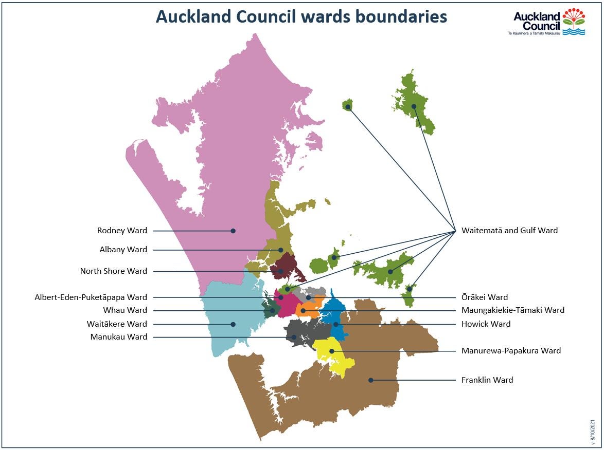
Ngā rohe katoa All wards
-
Albany Ward
Get information about the Albany Ward, and view a map.
-
North Shore Ward
Get information about the North Shore Ward, and view a map.
-
Albert-Eden-Puketāpapa Ward
Get information about the Albert-Eden-Puketāpapa Ward, and view a map.
-
Ōrākei Ward
Get information about the Ōrākei Ward, and view a map.
-
Franklin Ward
Get information about the Franklin Ward, and view a map.
-
Rodney Ward
Get information about the Rodney Ward, and view a map.
-
Howick Ward
Get information about the Howick Ward, and view a map.
-
Waitākere Ward
Get information about the Waitākere Ward, and view a map.
-
Manukau Ward
Get information about the Manukau Ward, and view a map.
-
Waitematā and Gulf Ward
Get information about the Waitematā and Gulf Ward, and view a map.
-
Manurewa-Papakura Ward
Get information about the Manurewa-Papakura Ward, and view a map.
-
Whau Ward
Get information about the Whau Ward, and view a map.
-
Maungakiekie-Tāmaki Ward
Get information about the Maungakiekie-Tāmaki Ward, and view a map.
Map of Auckland Council wards

