
Before we approve a Shoreline Adaptation Plan (SAP), we ask for feedback from the local community. This is so you can tell us your views about the future of our shorelines.
Kōrero mai mō ngā takutai ki Tāmaki Makaurau Have your say on Auckland's shorelines
SAP consultations are now closed across the region
Visit our Social Pinpoint map for a snapshot of the community feedback.
Timeline of SAPs by area
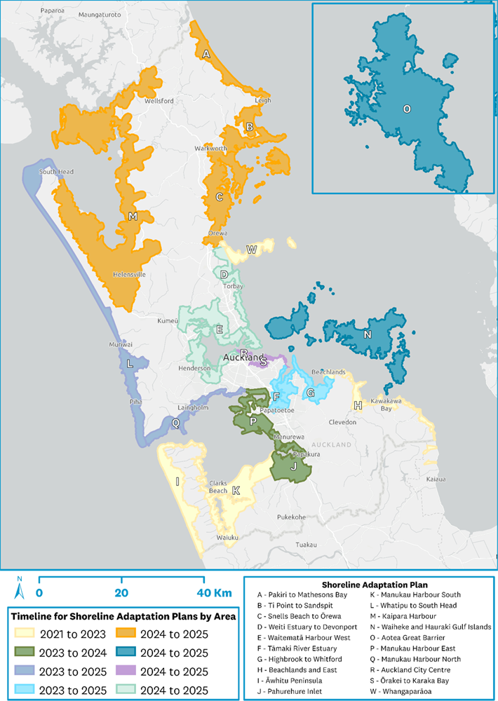
Map of Auckland's coastline showing each SAP area.
The map explained and current status for each SAP
The map uses colours and letters to show the timeline for SAPs by area.
2021-2023
Yellow – in areas W and H, SAPs were approved for:
Yellow – in areas I and K, SAPs were approved for:
2023-2024
Dark green – in areas J and P, SAPs were approved for:
2024-2025
Light green – in areas D and E, SAPs were approved for:
Within area E, a mini SAP in Waitematā Harbour West was approved for:
2023-2025
Violet – in areas L and Q, SAPs were approved for:
Light blue – in areas F and G, SAPs were approved for:
Orange – in areas A, B, C and M, SAPs were approved for:
Dark blue – in area O, the final SAP is available for:
Dark blue – in area N, consultations are closed. SAP is under review for:
Final reports will be available in late 2025.
Pink – in areas R and S, consultations are closed. SAPs are under review for:
Final reports will be available in late 2025.