Mahere Urutaunga o te Tapātai o Whangaparāoa
Whangaparāoa Shoreline Adaptation Plan (SAP)
The Whangaparāoa Pilot SAP considers the future of council-owned land and assets across Whangaparāoa's coastal areas in response to the impacts of coastal processes, climate change, erosion and flooding.
About the Whangaparāoa Pilot SAP
The Whangaparāoa Pilot was the first SAP we developed for the Auckland region.
The Hibiscus and Bays Local Board endorsed this SAP in February 2022, and the Environment and Climate Change Committee approved it in March 2022.
This SAP area includes the coastal parks, reserves and council assets in:
- Red Beach
- Stanmore Bay
- Big Manly
- Army Bay
- Shakespear Park
- Gulf Harbour
- Little Manly
- Arkles Bay/Wade Heads
- Weiti River.
We chose the Whangaparāoa Peninsula for our pilot SAP because it has:
- diverse coastal environments
- a history of coastal hazards
- a mix of Auckland Council-owned land and assets (such as roads, stormwater and wastewater pipelines, and coastal structures like boat ramps and wharves)
- strong, established communities
- cultural significance to several iwi groups.
Map of areas covered by the Whangaparāoa Pilot SAP
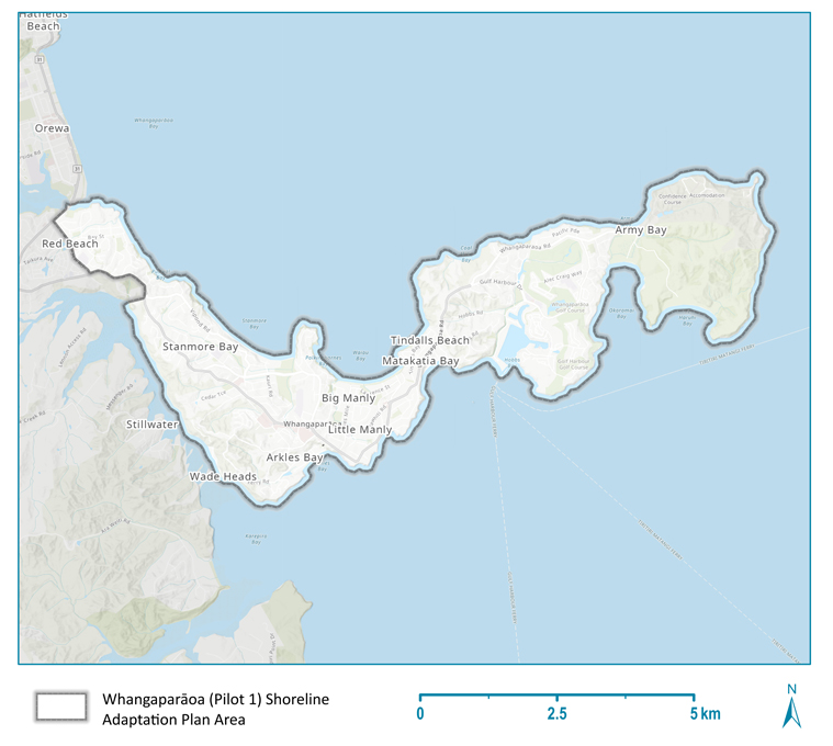
Map of the area covered in the Whangaparāoa Pilot Shoreline Adaptation Plan.
Stages of the Whangaparāoa Pilot SAP
- March 2022 - plan approved by the Environment and Climate Change Committee.
- February 2022 - plan endorsed by Hibiscus and Bays Local Board.
- November 2021- January 2022 - plan reviewed.
- August-October 2021 - plan drafted.
- May-July 2021 - plan developed.
- 30 March-15 July 2021 - plan opened for public consultation (community feedback).
- February 2021-March 2022 - local iwi engagement.
Read the full Whangaparāoa Pilot SAP report
Related topics
Is the information on this page helpful?
It is helpful for us to know what works well for customers.
You will not receive a reply. Do not include personal information.

