Mahere Urutaunga o te Tapātai o Kahawairahi ki Whakatiwai / Beachlands and East
Kahawairahi ki Whakatiwai / Beachlands and East Shoreline Adaptation Plan (SAP)
The Kahawairahi ki Whakatiwai / Beachlands and East Shoreline SAP considers the future of Auckland's eastern coastal areas.
About the Kahawairahi ki Whakatiwai / Beachlands and East SAP
This SAP provides important guidance for the sustainable management of council-owned land and assets in coastal areas in response to the impacts of coastal processes, climate change, erosion and flooding.
The Franklin Local Board endorsed the Kahawairahi ki Whakatīwai / Beachlands and East SAP in August 2022. The Environment and Parks Committee then approved the plan in March 2023.
This SAP covers the coastline from Pine Harbour in the Beachlands area to the coastline at Whakatīwai Regional Park.
This area includes (but is not limited to):
- Kauriwhakiwhaki / Beachlands
- Pine Harbour
- Maraetai
- Kawakawa Bay
- Matingarahi
- Ōrere Point
- and all the coastal areas in-between.
Map of areas covered by the Kahawairahi ki Whakatiwai / Beachlands and East SAP
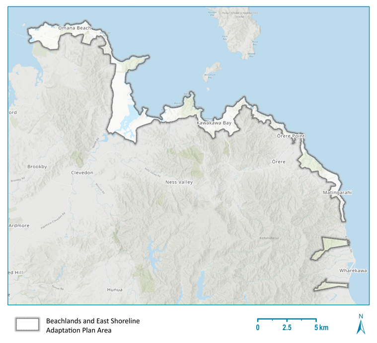
Map of the area covered in the Kahawairahi ki Whakatīwai / Beachlands and East Shoreline Adaptation Plan.
Stages of the Kahawairahi ki Whakatiwai / Beachlands and East SAP
-
March 2023: The Environment and Parks Committee approved the plan.
-
August 2022: The Franklin Local Board endorsed the plan.
-
February-April 2022: plan reviewed.
-
22 October 2021-25 February 2022: plan opened for public consultation (community feedback)
-
December 2021 – February 2023 – local iwi engagement.
Read the full Kahawairahi ki Whakatiwai / Beachlands and East SAP report
View the Social PinPoint feedback for the Kahawairahi ki Whakatiwai / Beachlands and East SAP
View the Social Pinpoint responses for Kahawairahi ki Whakatiwai Beachlands and East Shoreline Adaptation Plan.
Related topics
Is the information on this page helpful?
It is helpful for us to know what works well for customers.
You will not receive a reply. Do not include personal information.

