Mahere Urutaunga o te Tapātai o Manukau Harbour South
Manukau Harbour South Shoreline Adaptation Plan (SAP)
The Manukau Harbour South SAP considers the future of council-owned land and assets across the region's coastal areas in response to the impacts of climate change, erosion and flooding.
About the Manukau Harbour South SAP
The Policy and Planning Committee approved the Manukau Harbour South SAP on 3 August 2023.
This SAP covers the area from Rauau Point at Waipipi / Te Toro in the west, through to Karaka Point at the entrance to Pahurehure Inlet in the east.
Map of areas covered by the Manukau Harbour South SAP
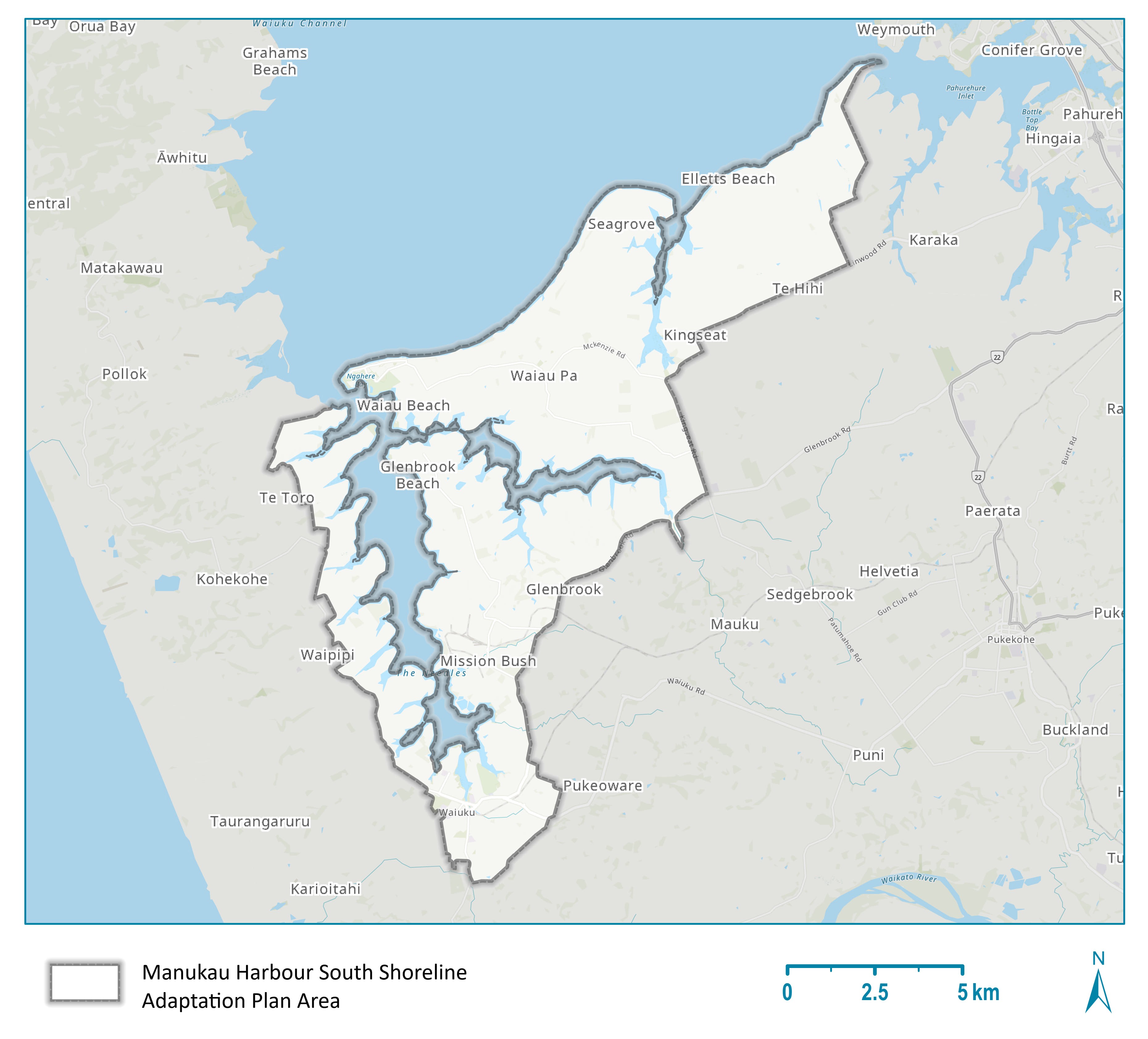
Map of the area covered by the Manukau Harbour South Shoreline Adaptation Plan
Stages of the Manukau Harbour South SAP
- 3 August 2023 - plan approved by the Planning, Environment and Parks Committee.
- April 2023 - plan endorsed by the Franklin Local Board.
- October 2022-January 2023 - feedback reviewed, plan drafted and developed.
- 14 July-14 October 2022 - plan opened for public consultation (community feedback).
Read the full Manukau Harbour South SAP report
Read the Manukau Harbour South SAP community objectives
Related topics
Is the information on this page helpful?
It is helpful for us to know what works well for customers.
You will not receive a reply. Do not include personal information.

