When to use the Locate tool
Use the Locate tool if you want to capture coordinates to use in other applications or to find a location, based on entered coordinates.
How to capture coordinates
Step 1: Click on the
Locate Tool.

Step 2: Navigate to the area of the map from which you want to collect a coordinate point.
Step 3: Click the
Capture button.
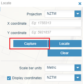
Step 4: Click on the part of the map you want to record a coordinate from. A resulting coordinate will appear on the tool.
Note: You can click as many times as you want to gather different coordinates. The values will appear on the map, but only the last value clicked will appear in the coordinates box of the Locate tool.
How to locate coordinates
Step 1: Click the
Locate Tool
Step 2: Zoom to the area of the map that you want to collect a coordinate point from. You can do this by using the
Search Tool, or by Panning and Zooming to your desired area of interest.
Step 3: Choose
Projection and Display Coordinates (these are the coordinates that will be displayed on the map).
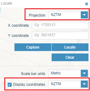
Note: the scale bar units will determine the units that are displayed in the scale bar.
Step 4: Enter the coordinates that you wish to find in the coordinates boxes.
Step 5: Click the Locate button. The display will zoom to the extent of the location and a label for the coordinate will show.
Step 6: Click Clear to clear all of the coordinate values on the map and in the Locate dialog box.
