Whakamahia ngā aronga ā-Mapi Tiriti ā-Kūkara i GeoMaps
Use Google Street Map views in GeoMaps
The Google Street View tool allows you to zoom to an area of interest within the map and interact with the street view capability.
Page Content
How to use Google Street View in GeoMaps
Step 1: Click on the person icon.

Step 2: Click on the location where you want to zoom for street view. The Google Street View panel will open at the bottom of your map.
Step 3: Search or pan and zoom to the part of the map that you are interested in seeing the street view imagery.
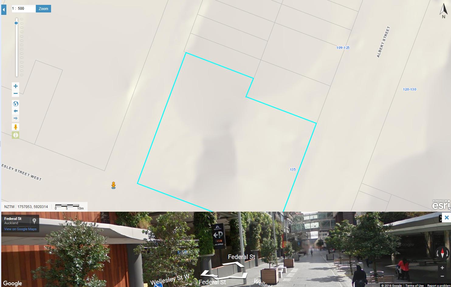
Step 4: To close the Google Street View tool, click on the small cross at the top right of the tool.
The imagery used in Street View is controlled by Google, not Auckland Council. Not all roads in Auckland region are yet covered by this imagery dataset.
Usage of the tool is covered by Google.
For more information, see
Google Street help.
Is the information on this page helpful?
It is helpful for us to know what works well for customers.
You will not receive a reply. Do not include personal information.
