Te tirotiro raraunga whāiti hāngai i roto o GeoMaps (ngā Mapi Aro Whenua)
Viewing metadata in GeoMaps
Page Content
Step 1: Select the layer you wish to view metadata for. You can locate the layer you want by selecting either:
Theme

Data Discovery

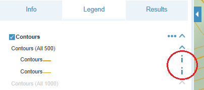
Step 2: Navigate to the Legend and click the i on the layer you want information about. If no i is present, click the drop down arrow to expand the layer.
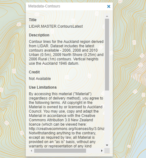
If metadata is available, a box will appear and display information on:
- Title
- Description
- Credit
- Use Limitations
- Extent
You should know
At the bottom of this pop-up box, there are buttons which allow you to copy to clipboard and also submit feedback.
Is the information on this page helpful?
It is helpful for us to know what works well for customers.
You will not receive a reply. Do not include personal information.
